
 English
 Deutsch
 中文
中文Ocean Currents and Tidal Currents
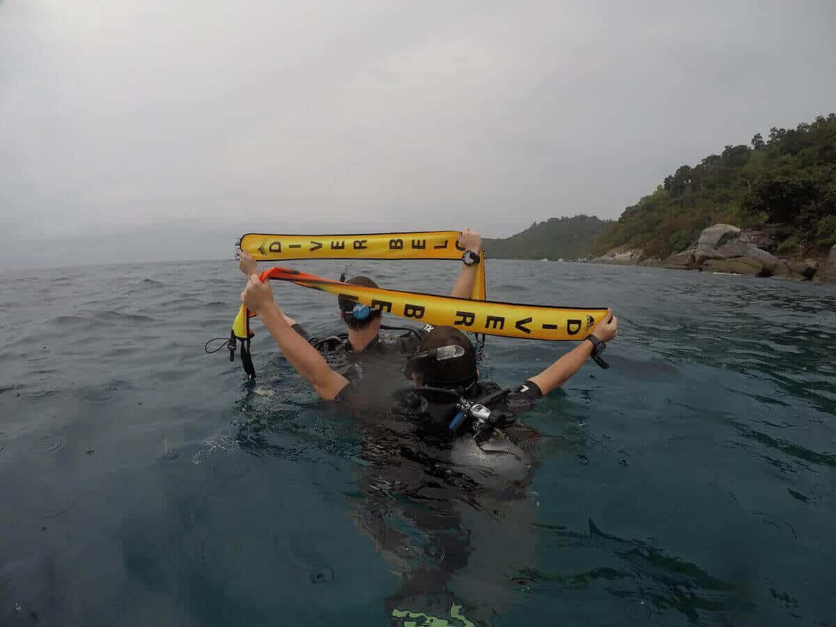
Understanding ocean currents and tidal currents is crucial for a safe and enjoyable scuba diving experience, especially in a diverse marine environment like Phuket, Thailand. At Aloha Diving, our team of experienced scuba diving instructors provides insights into these natural phenomena, ensuring divers are well-prepared for their underwater adventures.
What are Ocean Currents?
Ocean currents refer to the continuous, directed movement of seawater, driven by various factors such as wind, the Coriolis effect, temperature and salinity differences, and interactions with other currents. These currents are primarily horizontal movements of water and can significantly affect diving conditions.
In Phuket, ocean currents are influenced by broader oceanic and atmospheric phenomena, such as the Indian Ocean Dipole (IOD). The IOD alternates between positive and negative phases, affecting sea surface temperatures and leading to upwelling—where colder, nutrient-rich water rises to the surface. This upwelling can create internal waves—underwater waves that travel along the density layers of the ocean, known locally as the “green monster.” This phenomenon is characterized by cold, strong currents and a greenish or milky water appearance, particularly during positive IOD phases.
The Andaman Sea’s Tidal Cycle
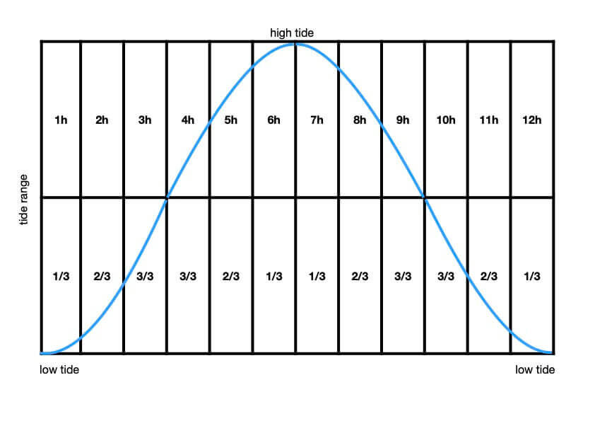
Phuket’s Andaman Sea features a semidiurnal tidal cycle, with two high and two low tides of approximately equal size every lunar day. This cycle is crucial for divers to understand, as it affects both the strength and direction of currents at various dive sites.
Tidal Currents: Understanding the Tidal Cycle
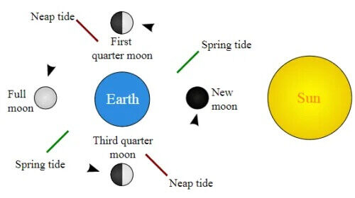
- Spring Tides: Occur every 14 days when the gravitational forces of the moon and sun align, resulting in high high waters and low low waters. These tides can produce strong currents, which divers should be cautious of.
- Neap Tides: Also occurring every 14 days, neap tides happen when the gravitational pull from the moon and sun is at right angles. These tides result in lower high waters and higher low waters, typically producing weaker currents.
Using Tide Charts for Dive Planning
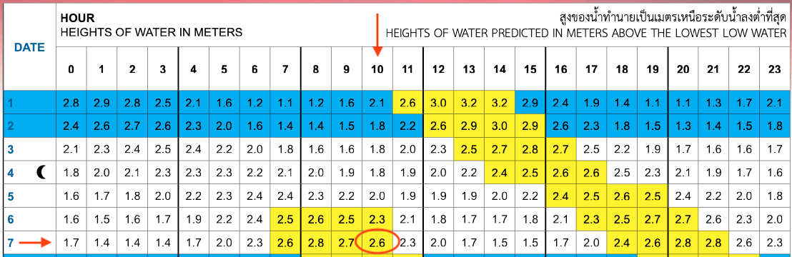
Tide charts are essential tools for planning dives in Phuket. These charts, available from the Royal Thai Navy and various apps, provide detailed information on tidal movements. Divers can use these charts to identify the best times for diving, ideally during slack water—when the tidal currents are weakest.
How to Interpret Tide Charts
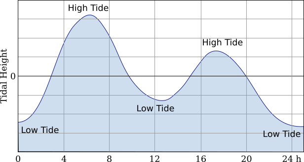
Tide charts are essential tools for planning dives in Phuket. They provide detailed information about the timing and height of tides, which helps divers anticipate current strength and direction. Here’s how to interpret these charts:
Reading the Tide Table:
- High and Low Tides: Look for the times listed for high and low tides. These indicate when the water level will be at its highest and lowest, respectively.
- Tidal Heights: The heights next to the times indicate how high or low the water will be. This is crucial for understanding the potential current strength.
Calculating Current Strength:
- Rate of Change: The difference in water height over time can indicate the strength of the current. A larger change in a shorter period usually means stronger currents. For example, a change of 0.1–0.2 meters per hour suggests a mild current, 0.3–0.4 meters a moderate current, and 0.5–0.7 meters a strong current.
Timing Your Dive:
- Slack Water: Ideally, plan dives during slack water, the period of minimal current between high and low tides. This is when the water movement is minimal, providing the calmest diving conditions.
- Tidal Flow: Be aware of the time relative to high or low tide, as currents can increase as the tide changes.
Current Directions at Popular Dive Sites
Understanding the direction of ocean currents at specific dive sites is vital for a successful dive:
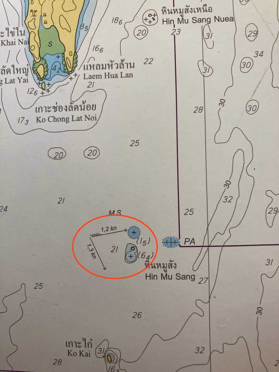
Shark Point (Hin Musang), Anemone Reef, King Cruiser shipwreck: Current flows east-northeast during high tide and south-southeast during low tide.
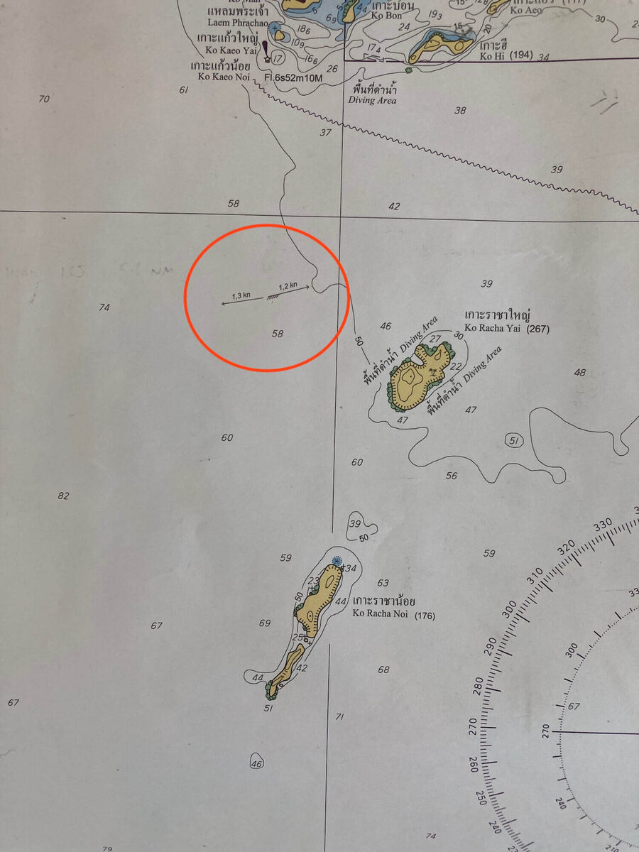
Racha Islands: Current flows east-northeast during high tide and west during low tide.
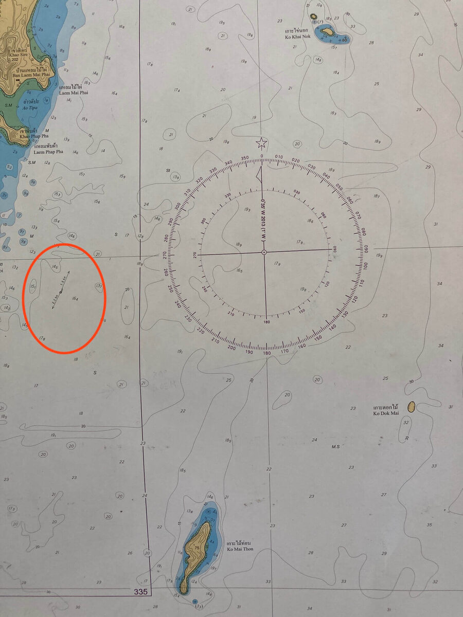
Koh Mai Thon and Koh Doc Mai: Current flows north to south, with northward flow during high tide and southward flow during low tide.
By understanding ocean currents and tidal patterns, divers can “go with the flow” for a more enjoyable dive or prepare for situations requiring navigation against the current. This knowledge is particularly useful for divers undertaking specialized courses such as drift diving or PADI Divemaster training.
When planning dives, also consider additional factors like wind and sea state, which can further influence diving conditions.
Related posts
Ensuring Clean Compressed Air for Safe Scuba Diving
What goes into making sure the air in your scuba tank is clean and safe to breathe.
Wind and Sea State
Why the weather on the beach doesn’t always tell you what the diving will be like.
Phuket Diving Industry
A closer look at how Phuket’s diving industry works behind the scenes.
Come dive with us.
We still plan every trip around small groups and calm water.